Research-Tour | small Group | privately guided
Research-Tour
The Research-Tour is a unique round trip through Namibia, offering you special insights into the country's nature. If you have always wanted to know how desert research works, then this is the tour for you. The Research-Tour is also aimed at those who may have already been to Namibia and are now looking for something special.
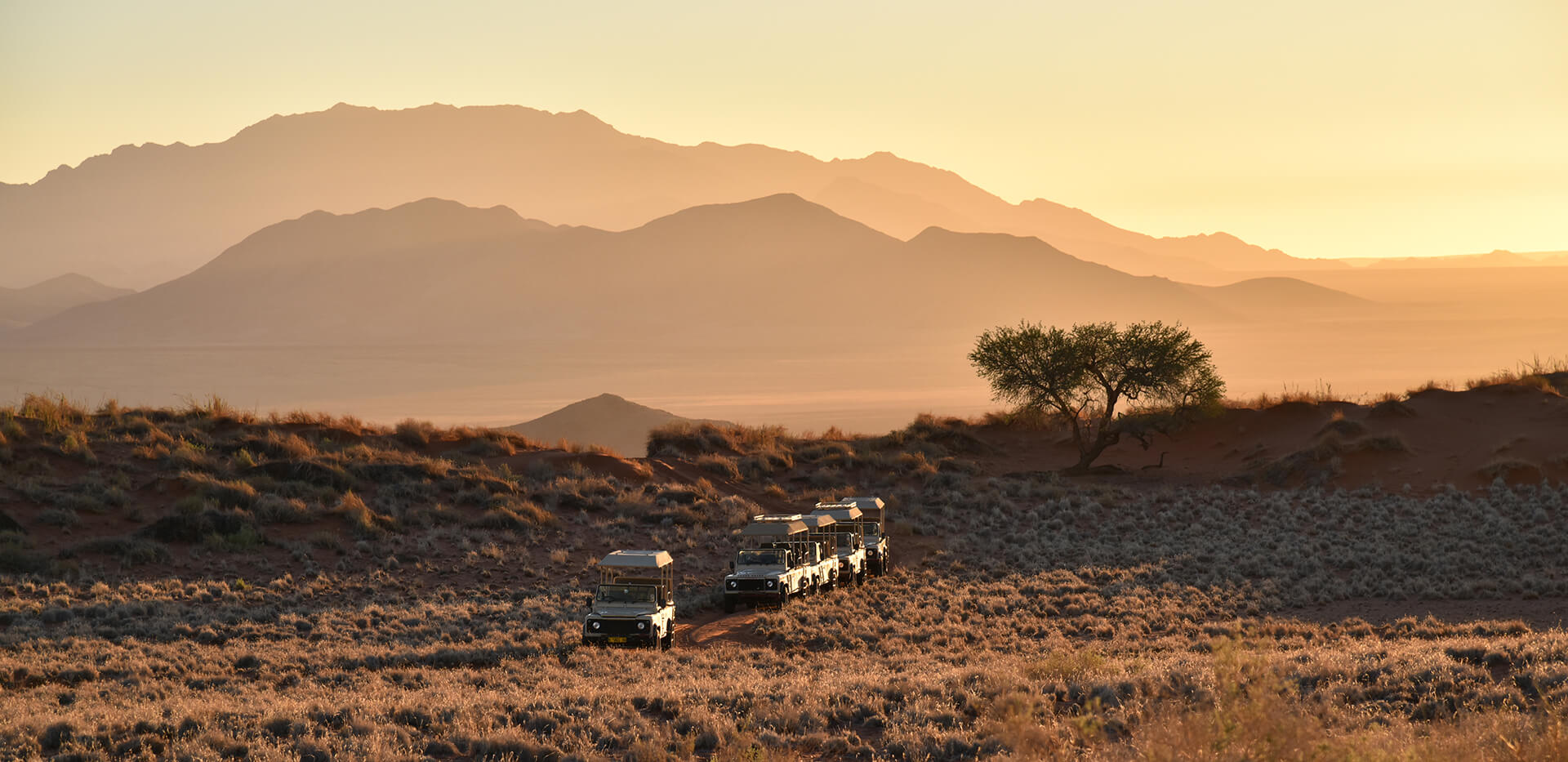
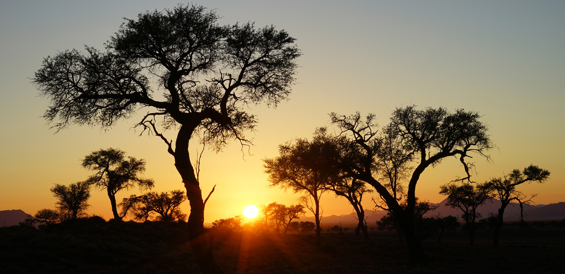
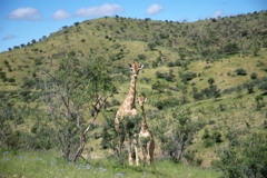
On this tour, we will visit a total of nine places where I have collected research data. We will start at the Daan Viljoen Game Park near Windhoek, where I studied hundreds of grasses in 1999. Here, I will explain how grazing by different wild animals affects the vegetation. The park has no lions or elephants, so it is easy to walk through the savanna. We will then drive towards the Tsondab Valley, where we will see a forest of moringa trees that I have surveyed several times with drones. There we will also learn about special grass rings and experience a unique sunset. From there, we will continue to the famous Gobabeb Namib Research Institute, founded in 1962. Here, we will learn about the importance of the Kuiseb ephemeral river for its giant trees and bird life. This strip of green vegetation, several hundred meters wide, is considered a “linear oasis” in the desert and enables a way of life that is otherwise only possible further east in the more humid interior. Other stops on the way to the coast include the Desert Botanic Garden near Gamsberg and the picturesque Donkerhuk West farm. In addition to various interesting plant species and plant rings, we will also explore the Welwitschia mirabilis, which is only found in the Namib. In Swakopmund, we will visit the natural history museum and, of course, the beach. From there, we will continue to the Brandberg, where we will explore euphorbia shrubs and fairy circles. We will continue via Twyfelfontein and the Huab River with its desert elephants to Fort Sesfontein. During a whole day in the Giribes Plain, we will see many large fairy circles, and I will also show you a very special place. After Sesfontein, we will spend another night in Damaraland and a final night in a wildlife-rich region near Mount Etjo. A safari at Mount Etjo will show you the entire range of wildlife that is otherwise only found in Etosha Park.
The Research-Tour offers you a balanced mix of special insights into nature and relaxation in very special places. The tour is designed for everyone and is aimed at all visitors who may want to venture away from Sossusvlei or Etosha.
-
Day 1
Arrival day in Windhoek
-


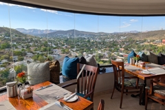
At the beginning of your trip, you will be transferred from the airport to the Hotel. Since most flights arrive in Windhoek in the morning, you will have time in the afternoon to get to know the city a little or to buy travel items such as a hat. We will prefer to stay at the remarkable Hotel Thule, which was originally the villa built in 1960 by the factory owner and millionaire Edmund Lafrenz. A suburb that still exists today was named after Lafrenz, the Lafrenz Industrial Area in the north of Windhoek. Should you wish to take a tour of the city, we will at first visit the Independence Memorial Museum which was inaugurated in 2014. The look-out platform of the Panoramic Hall provides a magnificent view over Windhoek and its surrounding landscape. Here is the best location to explain the dynamic development that Windhoek has gone through since its independence in 1990. According to an official census, Windhoek’s population has risen alone between 2001 and 2011 from over 233 000 to over 325 000 inhabitants. A census from 2023 already revealed a population of over 486 000. I have known Windhoek since 1996 and studied there from 1997 to 2000. The socio-cultural and urban development changes that Windhoek has undergone since then are remarkable. Especially during the past twenty years, new buildings have been built at many locations and have thereby changed the town picture. The current townscape consists thus of small old buildings from German colonial times around 1900 and modern fronts from the recent past. Our city continues via the Christus church and down to the Independence Avenue and Post Street Mall with its many stores, restaurants and gift shops. The first evening in Windhoek we will end in the legendary Joe’s Beerhouse where you get delicious and Namibian authentic barbecue food. Since 1991, Joe’s is THE address for visitors of the country and there is an un-official saying “You have not been to Namibia if you have not been to Joe’s”.
Included services: Airport transfer, accommodation
-
Day 2
Windhoek - Tsondab Valley
-

 in Daan Viljoen Game Park")


, people (center), and giraffes (right)")


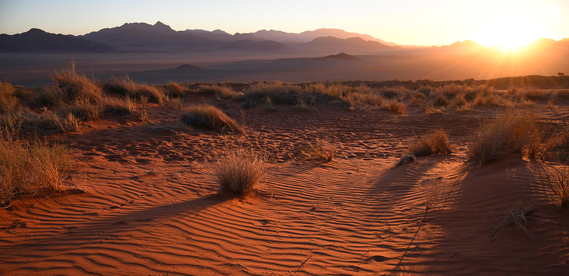
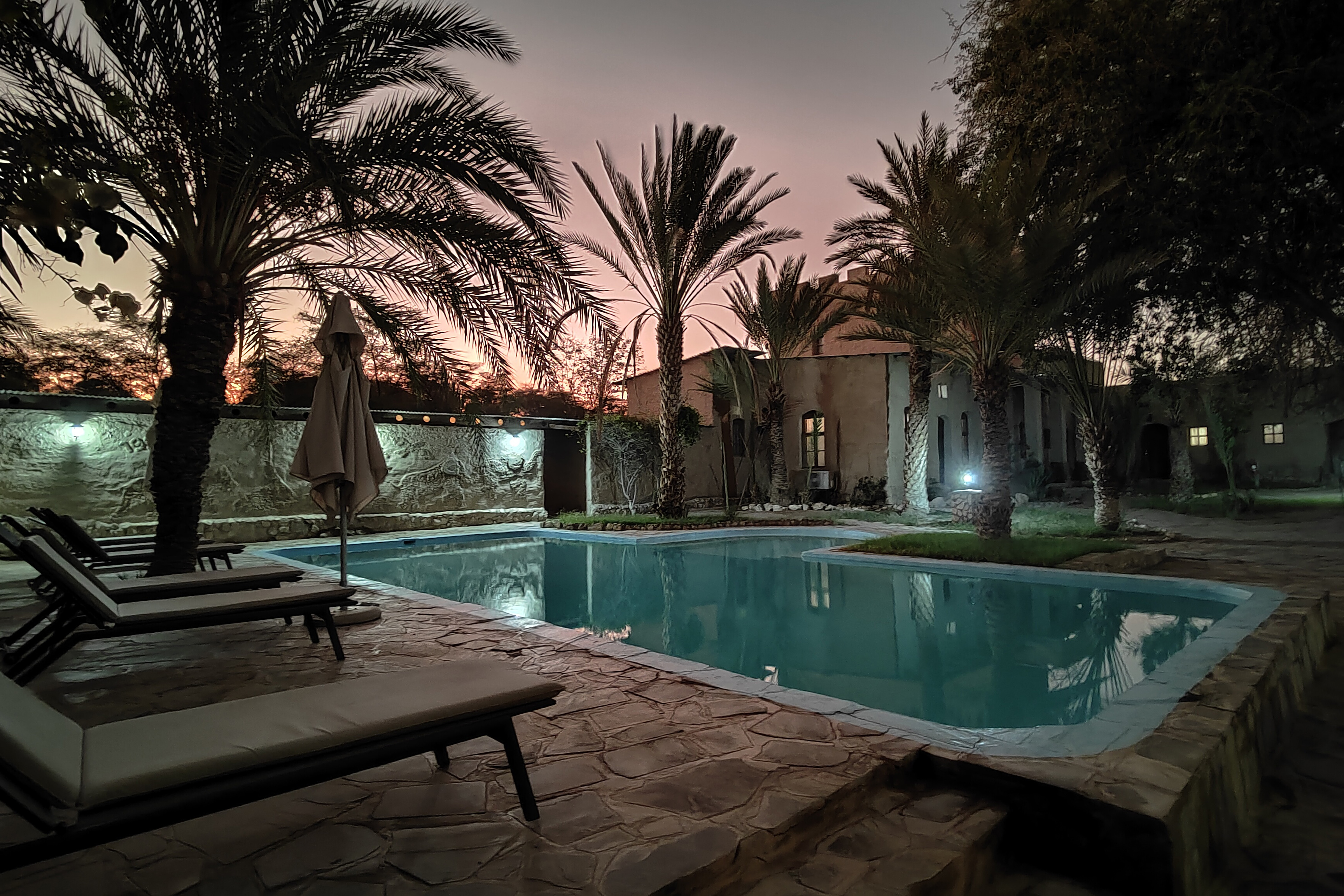
In the morning, we drive to the nearby Daan Viljoen Game Park, which is home to many wild animals such as giraffes, wildebeests, oryx, springboks, zebras, kudus, baboons, and warthogs. It is part of the highland savanna and is located at an altitude of 1,600 to 1,800 meters above sea level. The average annual rainfall is around 350 mm, which means that many different types of grass grow in the park. In 1999, I mapped hundreds of grasses from 26 different species there, depending on their distance from water sources. The composition of grass species changes strongly with increasing grazing pressure near water sources. The grass species can therefore be used to measure exactly how severe or advanced overgrazing is. I will be happy to tell you about this study as we walk through the park. For more detailed information, the study is also published online. We then leave the central Khomas Highland and drive west to the Great Escarpment, below which lies the Namib. As Namibia gets its rain from moist air masses from the northeast, a trip to the Namib in the west is always an increasing immersion into the dry desert. During the day trip, you will see how the height of the trees and the vegetation in general decrease. Trees prefer deep groundwater, whereas grasses absorb water more from the upper soil. This distribution of resources ultimately enables the existence of savannas – an explanatory idea that dates back to the German ecologist Heinrich Walter and the 1930s. In 2013, we summarized this explanation of the savanna phenomenon in a comprehensive overview article. When we reach the Great Escarpment, we will enjoy the view at one of Namibia's most spectacular passes – the Spreetshoogte Pass. From there, you can look down hundreds of meters into the Namib. From then on, it's all downhill, and we will soon reach the Namib-Naukluft Lodge at the entrance to the Tsondab Valley, where we will stay for two nights. In the immediate vicinity of the lodge, there is a small granite hill with numerous well-preserved Bushman paintings. These rock paintings are very delicate and at least 500 years old. From this hill, you can enjoy a magnificent sunset in the evening. Directly behind the lodge, by the swimming pool, you can walk along the rocky outcrops and find a nice spot. The sunset in the Tsondab Valley is a feast for the eyes from every vantage point.
Included services: Accommodation, breakfast, dinner, park fees
-
Day 3
Tsondab Valley
-


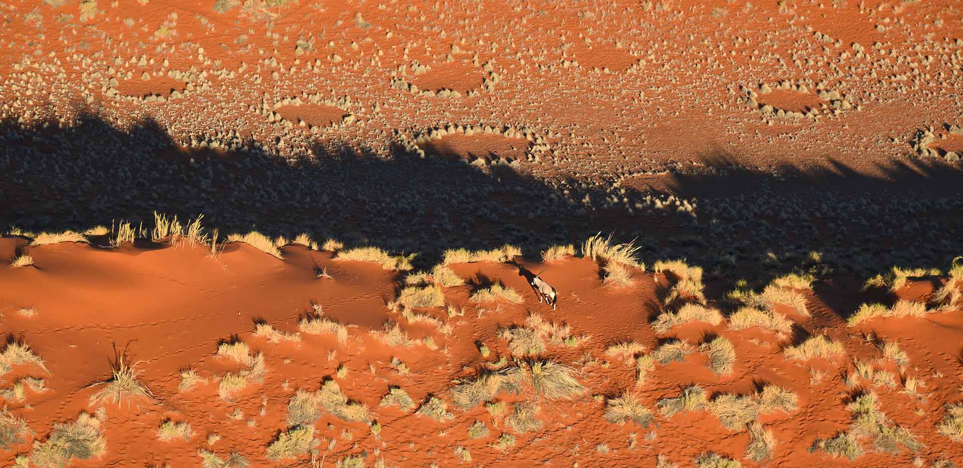
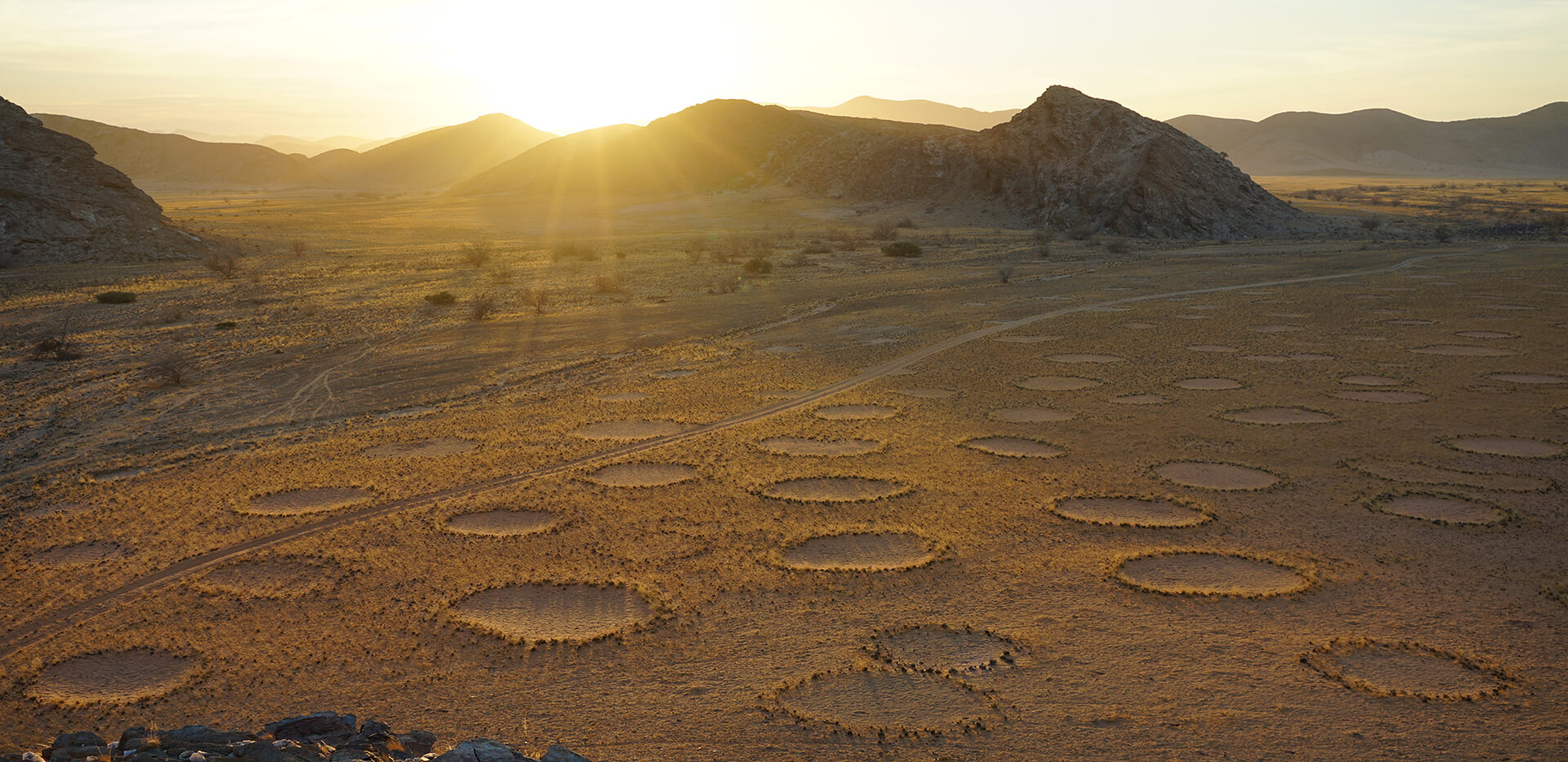
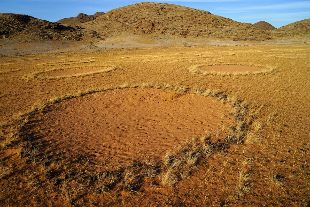
The area at the entrance to the Tsondab Valley is very dry, with average annual rainfall of less than 100 mm. Here, you can clearly observe how plants and animals have adapted to the lack of water. Even at breakfast in the morning, you will see numerous birds such as sociable weavers, glossy starlings, bustards, and rock pigeons, all gathering around the nearby waterhole. Wildebeests and oryx antelopes also like to visit the waterholes. On a drive through the surrounding area, we will see special plant rings of the grass species Eragrostis nindensis, which I have been measuring there for several years. This grass is also known as “eight-day grass” because it turns green a good week after the rain. This grass only forms rings when there is a severe water shortage, because where it is more moist, such as further inland, it forms closed grass clumps. These grass rings belong to more than a dozen plant species, all of which form rings in the Namib. We mapped these plant rings for the first time in 2020. Despite their great diversity, none of the rings have ever been described. I have therefore specifically studied these plant rings of the Namib in a multi-year research project. The research results on the grass rings studied at Namib Naukluft Lodge and in 40 other areas have been available online since December 2025 in a publication entitled Ring-formation in a Namibian resurrection grass and its relation to climate, neighborhood competition and soil microbes . On our Research-Tour, we can take a closer look at the rings, because often even small, inconspicuous adaptations are particularly interesting in the desert. In the afternoon, we can then drive west, where we will also see fairy circles. These fairy circles, like the smaller plant circles, are circular because the grasses suck the water out of the soil. I also took measurements on site for this. The circular shape is a special adaptation of the grasses to the water shortage that permanently prevails in this region of the Namib. Afterwards, we will continue to a “forest” of moringa trees. Such large concentrations of moringa trees are very special in Namibia. I have mapped this moringa forest with drones to find out to what extent the trees depend on the lines of the surrounding dry rivers. When it rains in the desert, small depressions can collect vital water and thus greatly influence the distribution of vegetation. Some tree species are therefore more dependent on the riverbed, while others are less so because, for example, they have particularly deep roots or because they can store a lot of water in their thick trunks, as moringa trees do. After we have looked at this forest, we can end the day with a particularly beautiful sunset. The crowning glory of the day is once again dinner under the starry sky.
Included services: Accommodation, breakfast, dinner
-
Day 4
Tsondab Valley - Gobabeb
-


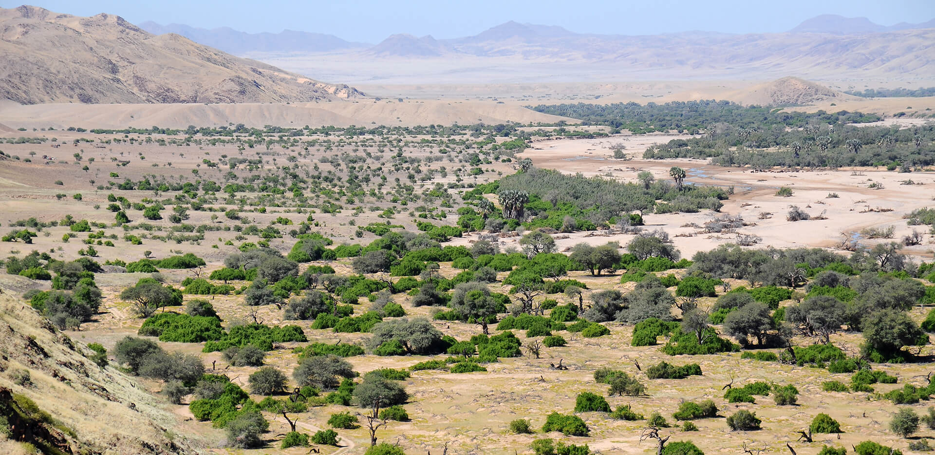
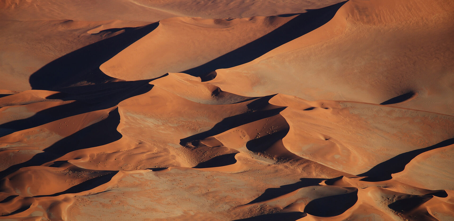
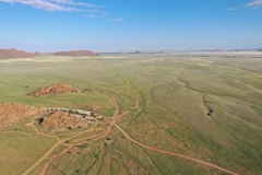
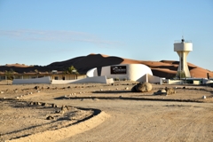
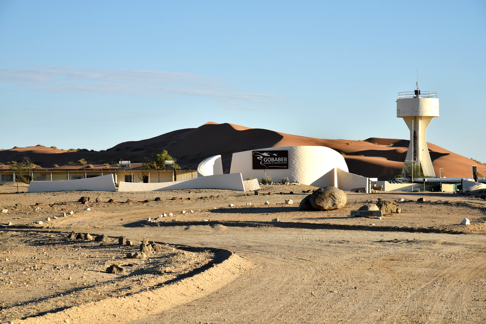
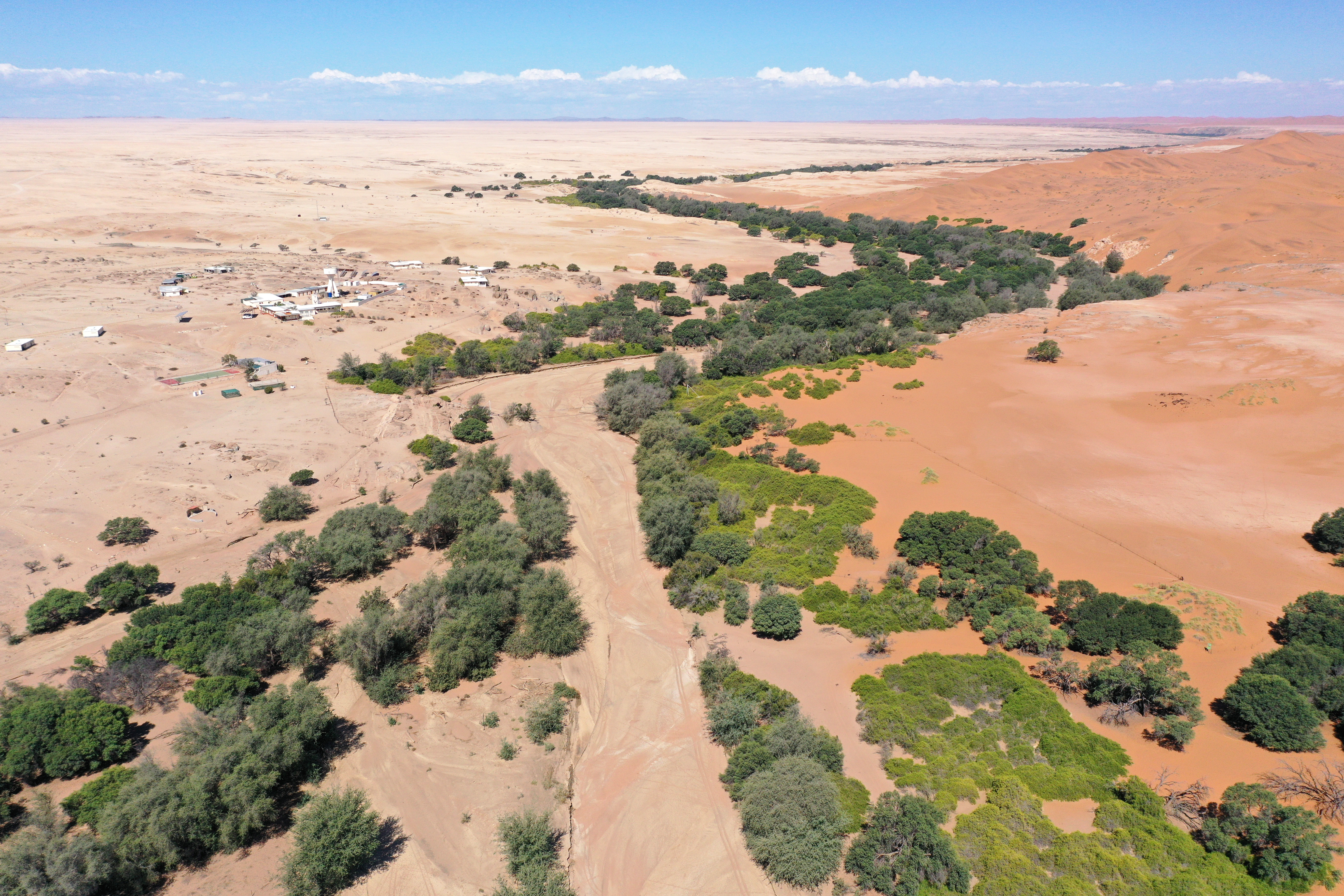
Today we drive to the Gobabeb desert research station. First we pass through Solitaire with its small gas station and famous bakery. Then we cross the Gaub Canyon and drive around the striking Rotstock Mountain. If desired, we can drive towards Gamsberg and visit the Desert Botanic Garden on the Berghof Farm. Various desert plants such as aloe and lithops are grown on this farm. We continue westward to the Kuiseb Canyon, where it becomes increasingly dry. The landscape is almost always very barren and without grass cover. Only in exceptionally good rainy years, such as 2022, can the landscape transform into a green carpet within a very short time. After crossing the Kuiseb Canyon, we will visit a beautiful viewpoint where you can see far into the canyon. The Kuiseb, with its partly long-lasting watering holes, which stay in the shade of the high canyon rocks, has also secured a survival for two German geologists at the beginning of the Second World War. In order to avoid their own imprisonment, Henno Martin and Hermann Korn hid in the Kuiseb gorges in 1940, where they lived for two and a half years a primitive life as hunters, constantly driven by hunger. Henno Martin’s book “The Sheltering Desert” impressively describes the Robinsonade of that time and the book is regarded as a homage to the sparse, but nevertheless enchanting beauty of the Namib Desert. On our tour we will visit the so-called Carp Cliff, the first “flat” of the geologists, also known as Henno Martin & Hermann Korn Shelter. Then we drive towards Gobabeb, where we see the red sand dunes getting closer and closer on our left. The name of the Gobabeb desert research station originates from the language of the local Nama people, the Topnaar. The Topnaar live exclusively along the Kuiseb River and are the only people permitted to settle permanently in the Namib-Naukluft Park. Gobabeb was built on the site of a former Topnaar settlement called !Nomabeb, which means “place of the fig tree”. The original fig tree that gave the place its name has long since disappeared. However, fig trees can still be found elsewhere along the dry Kuiseb River. In the late afternoon, we can climb Gobabeb's “house dune”, which offers a magnificent view of the landscape. From here, the linear dunes stretch over 300 km south toward Lüderitz. To the north, you can see the flat gravel desert and, in between, the Kuiseb River with its green trees. We will stay in Gobabeb for two nights because it is a very special place with lots to see.
Included services: Accommodation, breakfast, dinner, park fees
-

Day 5
Gobabeb
-


 and ana trees (yellow) grow along the river")


Gobabeb bietet auch einen sehr beeindruckenden Sternenhimmel, den wir in der Nacht erkunden können. Mit einer UV-Lampe lassen sich nachts auch Skorpione finden, die hin und wieder an Bäumen im Kuiseb sitzen. Gobabeb was founded as a desert research station in 1962. The location was carefully chosen because it is ideal for studying the botanical and zoological diversity of the desert. Gobabeb lies at the intersection of three different habitats: the Namib Sand Sea in the south, the gravel desert in the north, and in between, the Kuiseb, a dry river that only flows for a few days or weeks during good rainy seasons. It is an important linear oasis, as it enables the growth of large trees that form a green belt through the barren Namib. This ribbon helps many wildlife and bird species to survive even during the most severe droughts. Gobabeb has a hyperarid climate with less than 30 mm of rain on average over the long term. However, fog rolls in from the Atlantic on more than 90 days a year, providing an important source of water for many animal and plant species. I first got to know Gobabeb in 1998 during my studies in Namibia on an ecological excursion. During that week-long trip, we learned how the fog-basking beetle stands on its head to let the morning dewdrops flow into its mouth, and how the dune grass Stipagrostis sabulicola filters water droplets from the fog. We also buried bucket-like traps in the dune sand to identify the lizards, geckos, and beetles caught in them in the morning. Gobabeb attracts a large number of scientists every year. Back in 1998, researchers built a glass pyramid in which they placed sponges so that they would soak up water at night. In the morning, the researchers closed the side walls of the pyramid and the sun evaporated the water from the sponges, causing precious water to run down the windows. This is just one example of creative research at Gobabeb. As an associate member of Gobabeb, I regularly visit the research station. Among other things, I study how different tree species such as camelthorn trees and ana trees develop over the years in the Kuiseb. To do this, we have been mapping the same forest areas with drones every year since 2020 and analyzing the distances of the trees from the water-bearing riverbed. This allows us to evaluate the death of trees depending on their distance from the water. Camelthorn trees have particularly deep roots and are less compelled to grow close to the riverbed. On our research tour, we will have plenty of time to get to know the diversity of desert life in Gobabeb. In the riverbed, you can observe the diversity of birds with a spotting scope or binoculars. Masked weavers, red-eyed bulbuls, scimitarbills, and many other species can be seen. In the morning mist, you can see the fog-basking beetle or its particularly fast relative, the Narra beetle Onymacris plana, on the dunes. In the shady riverbed, we can marvel at the giant trees, even when the day is already well advanced. We will also see the nara plants, which belong to the pumpkin family. With their large fruits, they are particularly valuable to the indigenous Topnaar people, a Nama tribe that lives only on the Kuiseb River. Gobabeb is ideal for gaining insights into desert research. In the afternoon, we can drive to Homeb on the Kuiseb. There, just 14 km east of the desert research station, is the Welwitschia Wash. This tributary to the Kuiseb is home to over 160 plants, representing the southernmost population of Welwitschia mirabilis. It is the only extremely long-lived, non-clonal plant species that occurs in hyperarid desert conditions. We will take a closer look at the Welwitschias two days later on our way to Swakopmund. On this day, there is also the opportunity to take a guided tour of the station, where, for example, the special water treatment process, power generation, and the many measuring instruments that can be seen everywhere around the station are explained. In the evening, I offer a one-hour lecture in which topics related to desert ecology and desert climate are discussed with rich illustrations. Examples of such a lecture can be found in a summary of my workshop for tour guides. Gobabeb also offers a very impressive starry sky, which we can explore at night. With a UV lamp, you can also find scorpions at night, which occasionally sit on trees in the Kuiseb.
Included services: Accommodation, breakfast, dinner, park fees
-

Day 6
Gobabeb - Donkerhuk
-


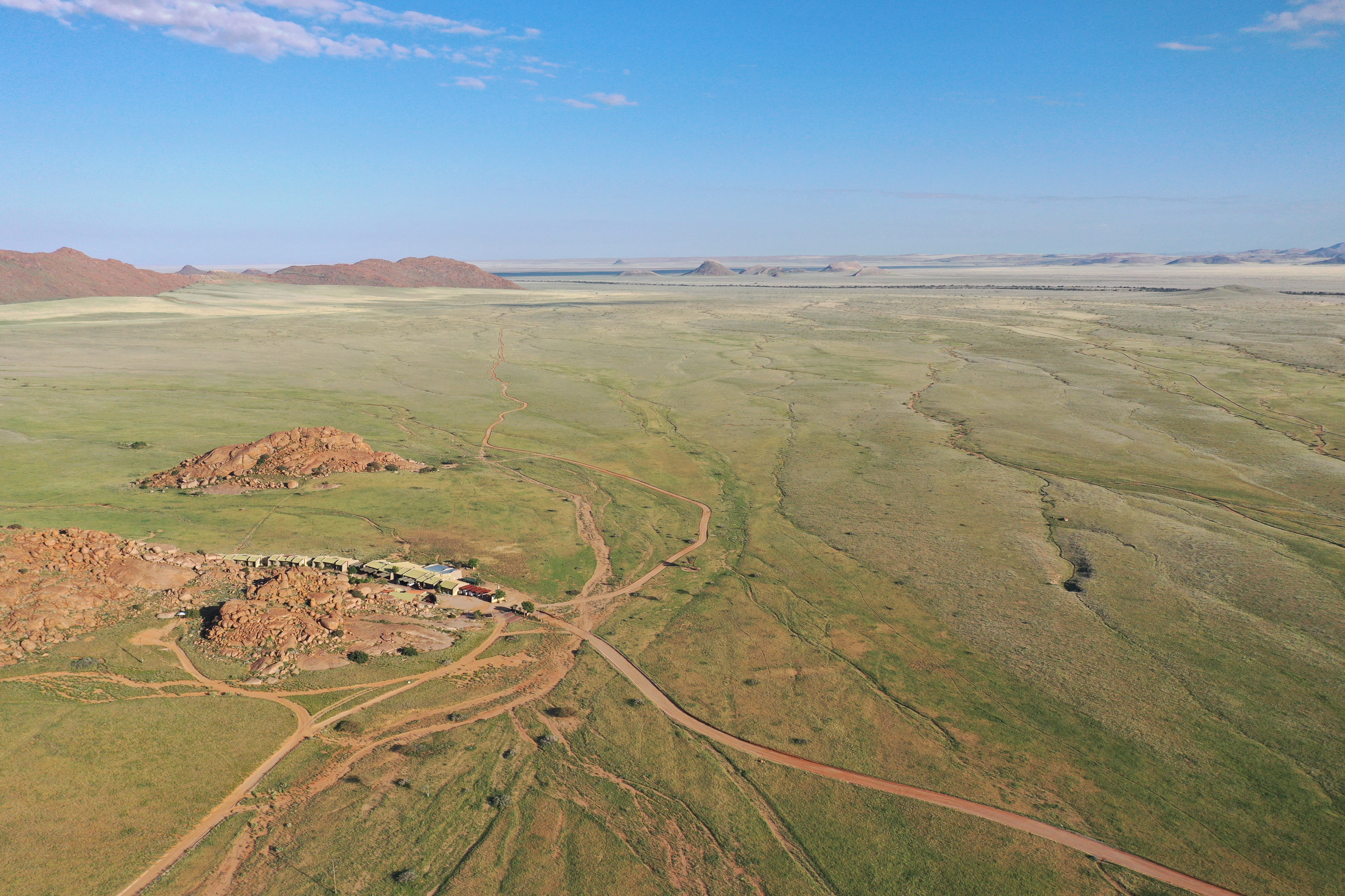
In the morning, we can go back to the Kuiseb riverbed to watch birds. We will only drive 150 km today, so we will have plenty of time for morning activities in Gobabeb. After visiting the desert research station, we will head back inland to the northeast to the Donkerhuk West Farm. Right at the start, we will pass the striking rock formation of Mirabib. Along the way, we will also see one or two fairy circles, at least if it has rained recently and some grass has grown. Otherwise, you will often see a strange counterpart to fairy circles – namely “filled” circles with many individual grasses in their center. These round grass islands are caused by the burrows and tunnels of the dune hairy-footed gerbil (Gerbillurus tytonis). This has been confirmed by a study conducted by Gobabeb. Creating ridges loosens the soil, making it easier for grass seeds to take root and for water to penetrate. This promotes the germination of grasses in the circles. On our journey, we stop near Arechadamab Mountain, where we can see the “eight-day grass” again. The adaptability of the grass is particularly evident in this location. There, the grass forms rings only on the flat plains. However, when water flows down a slope from the mountains, the grass forms crescent-shaped dams. This adapted growth form allows it to collect more water and thus ensures its survival in the desert. We then drive to Gemsbok Water and hope to find zebras or oryx there. Now it is not far to Donkerhuk, as the farm is located near the border of Naukluft National Park. At Donkerhuk, we will be welcomed by Chris Baas, who has been managing the beautiful farm for many years and has a self-sufficient garden behind the reception house. Chris grew up near the farm as a child and entertainingly recounts typical farm life. He regularly measures the rainfall in every corner of the farm and knows exactly why some boreholes sometimes have a lot of water and sometimes very little. Chris was also a tour guide for a long time, so half of Namibia knows him. With his support, I have conducted many studies on plant rings at Donkerhuk, as there are many different types of grass and herbs that form rings there. Over several years, we have taken measurements with solar-powered soil moisture sensors, studied the microorganisms in the soil, and mapped the rings with drones. Donkerhuk has particularly large grass rings that we can observe. The farm is scenically beautiful, and it's a great place to watch birds, hike, enjoy the sunset from a viewpoint, or sit around the fire in the evening. Donkerhuk is ideal for getting up close and personal with the Namib's nature. We will therefore also spend the night in sturdy tents, where you can best hear the sounds of the night and the morning. In the evening, there will be another highlight with the canyon dinner. Near the tents, there is a small rocky gorge where a river occasionally flows through during heavy rainfall. There, we will end the day by torchlight and candlelight.
Included services: Accommodation, breakfast, dinner, park fees
-

Day 7
Donkerhuk - Swakopmund
-


 and dollar bush (right) have special leaves to protect themselves from evaporation")


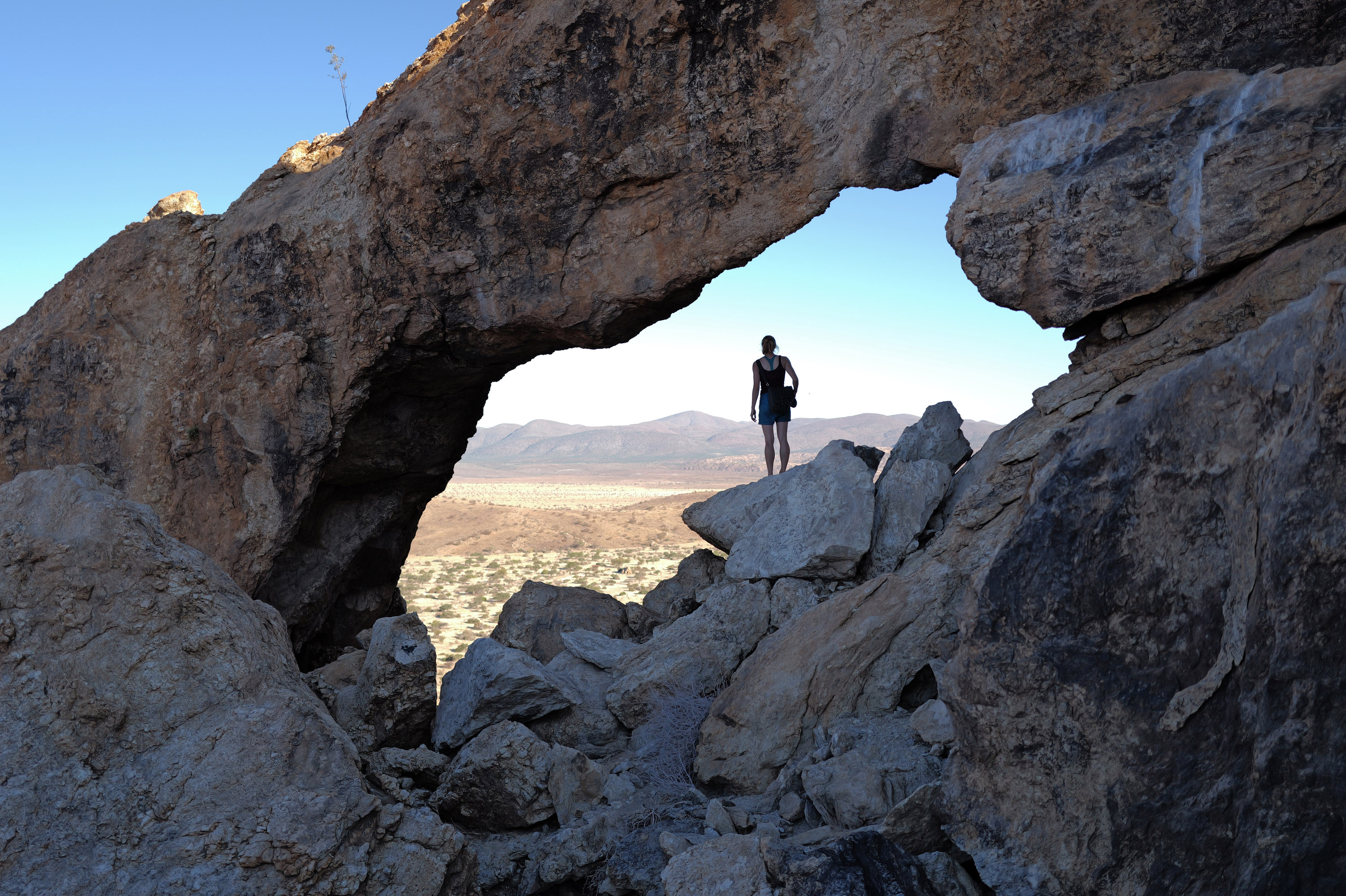
In the morning, Donkerhuk is ideal for a short hike. Those interested in the rich bird life can also use binoculars to look for francolins, glossy starlings, and many other birds. I always carry my Swarovski spotting scope with 25× to 60× magnification, so we can get up close to the birds and other animals in the valley. Then we leave Donkerhuk and drive west on the C28 road. Here we can stop at the Bloedkoppie and take a look at this striking granite rock. The Bloedkoppie is an inselberg that I have known since 1997. Back then, I went there with our Australian ecology lecturer, Grant Wardell-Johnson, to identify all the plants on the Bloedkoppie. Such inselbergs are hotspots of biodiversity because they accumulate seeds blown by the wind or because animals seek water there and bring seeds from the surrounding area. At the Bloedkoppie, there are also huge Euphorbia virosa, considered the most poisonous spurge plant in Namibia. We also find another example of plants that store water in a thick trunk in the desert: the quiver tree (Aloidendron dichotomum, formerly known as Aloe dichotoma). The name quiver tree comes from the branches, which the Bushmen of the San people used to use as quivers for hunting. The word “dichotoma” also comes from the branches, which always divide into two further branches. At the Bloedkoppie, there is a particular quiver tree that I have been photographing repeatedly since 1999. The photos show how slowly the tree grows in this extremely dry desert. The journey then continues through the deep valley of the Swakop River, which has a huge catchment area in central Namibia and, as its name suggests, flows into the town of Swakopmund. On the north side of the Swakop are the Welwitschia plains with these ancient Welwitschia mirabilis. I had already measured these plants in 1998 on a student excursion further north. Here at the Swakop, however, you can find particularly large specimens that are especially old. These Welwitschias can be over 2000 years old and grow to a height of 1.5 m. They consist of only two constantly growing leaves, which fray more and more over the years but are never shed. These plants are dioecious, meaning there are male and female plants. They are very special because they only occur along the Namib, their average age is 500-600 years, and like conifers, they are gymnosperms. We continue to the Moon Landscape, where we find the remains of a German colonial army camp along the way. The old cans and bottles at the rest stop have been lying there unchanged since 1915. They testify to how well the desert preserves objects left behind by humans. At the Moon Landscape, we can then look down into the Swakop Valley. Here, the barren desert really does look like the moon. On the rest of the way to Swakopmund, we will keep our eyes open for special desert plants and animals. If we are lucky, we may spot one or two desert dwellers such as the Namaqua chameleon, which is one of the largest chameleons in southern Africa, measuring up to 25 cm in length. We will also see the dollar bush (Zygophyllum stapfii) and the pencil plant (Arthraerua leubnitziae). The dollar bush gets its name from its round, coin-shaped leaves, which store water. The plant turns the edges of its leaves towards the sun to protect itself from evaporation and dehydration. The pencil plant has thin, pencil-like leaves to minimize evaporation. Now we drive to the coast, where we will arrive at the Hansa Hotel in Swakopmund in the late afternoon. In the early evening, we will explore the city and find a nice restaurant. Swakop is a great place to enjoy fish, squid rings, or other seafood.
Included services: Accommodation, breakfast, park fees
-

Day 8
Swakopmund
-


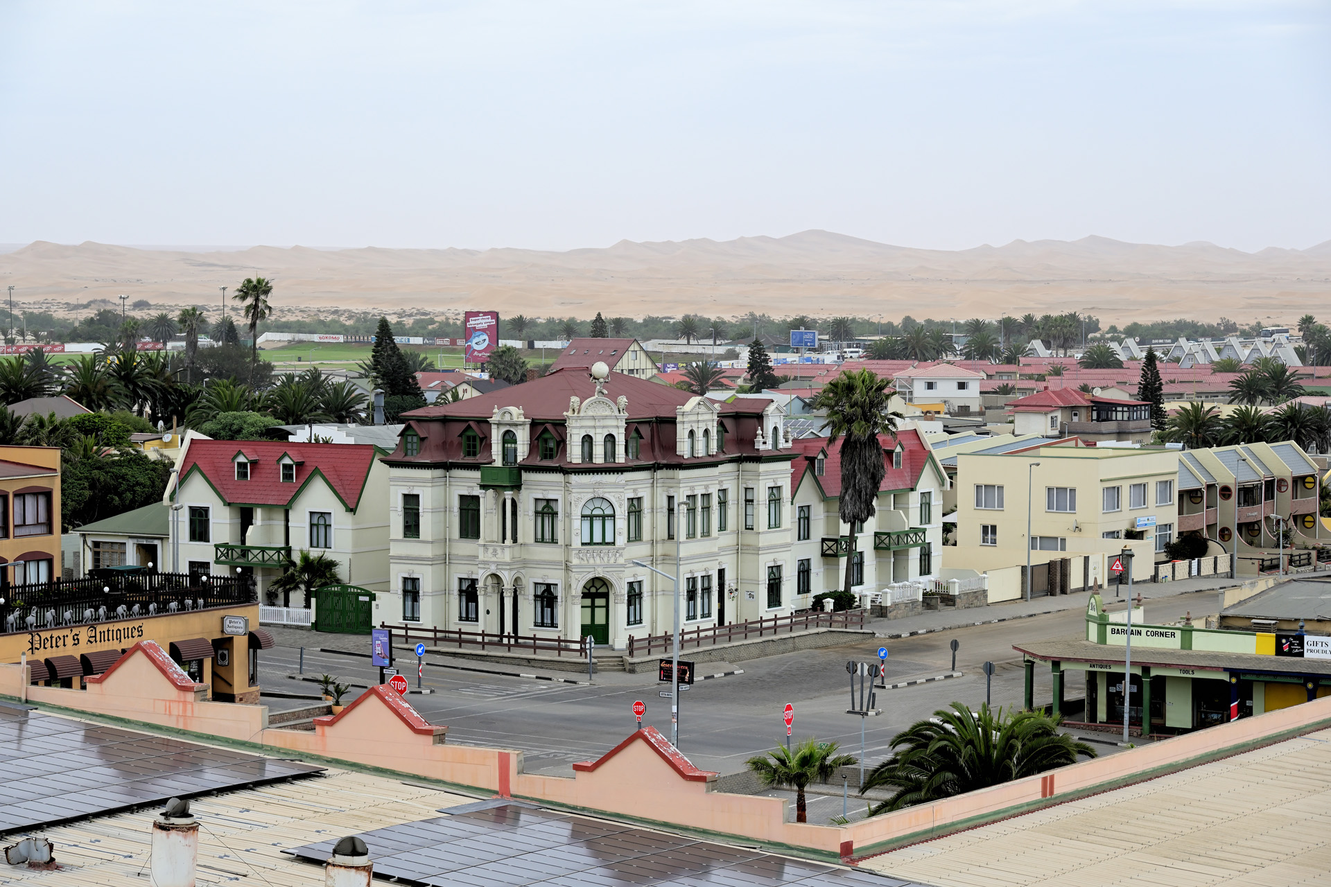
Today you will experience a day of relaxation, as we will not travel much or at all by car, depending on your needs. Instead, you will have plenty of time to discover Swakopmund and its coast. Perhaps in the morning there will still be the typical coastal fog in the town caused by the cold Benguela current from Antarctic waters. The cool air masses hit the hot air of the Namib Desert on the coast, the heavier cold air pushes itself under the hot air and condenses to fog – which makes Swakopmund at least 120 days per year to a climatically very pleasant residence. For this reason, the town is very popular among the local people of Namibia, who like to “escape” from Windhoek in the centre of Namibia to the coast, especially during the hot Christmas season. But also the life of the plants and animals is strongly influenced by the coastal fog, as the sparse rainfall of only about 20 mm per year is extremely low. Many insects and even shallow-rooted grasses are thus dependent on condensing water droplets or on the wetting of the soil surface with dew. After breakfast, you will have the opportunity to explore Swakopmund. The town offers many souvenir shops, clothing and book stores, cafes, a long pier, and of course plenty of beach and sea. Bookstores such as “Die Muschel” or the “Swakopmunder Buchhandlung” are excellent places to buy nature guides. Take your time and explore the old buildings, some of which are more than one hundred years old. For example, there is the tower of the Woermannhaus, from where you can see the jetty and the high sand dunes behind Swakopmund. The beautiful Swakopmund Museum offers many insights into the history, culture and nature of Namibia. A visit to the National Marine Aquarium of Namibia is also highly recommended. Most of the attractions are only a few hundred meters away from the Hansa Hotel, so that you can comfortably reach any place. But maybe you don’t want to do anything at all and just want to send a few photos via the internet. This will also be possible on this relaxing day before we will go to the Damaraland the next day.
Included services: Accommodation, breakfast, entrance fees for museum
-

Day 9
Swakop - Brandberg
-


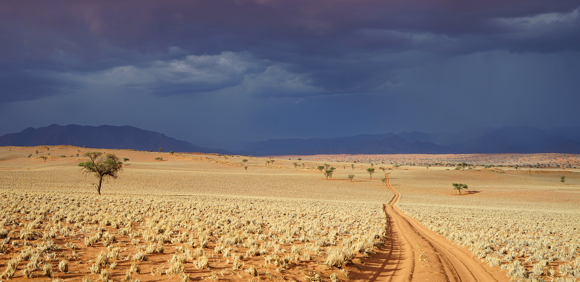
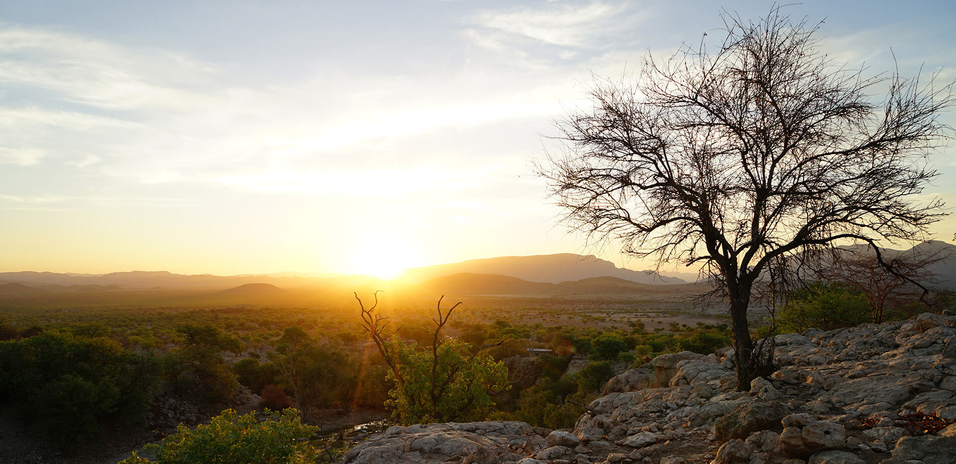
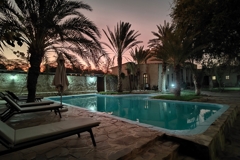
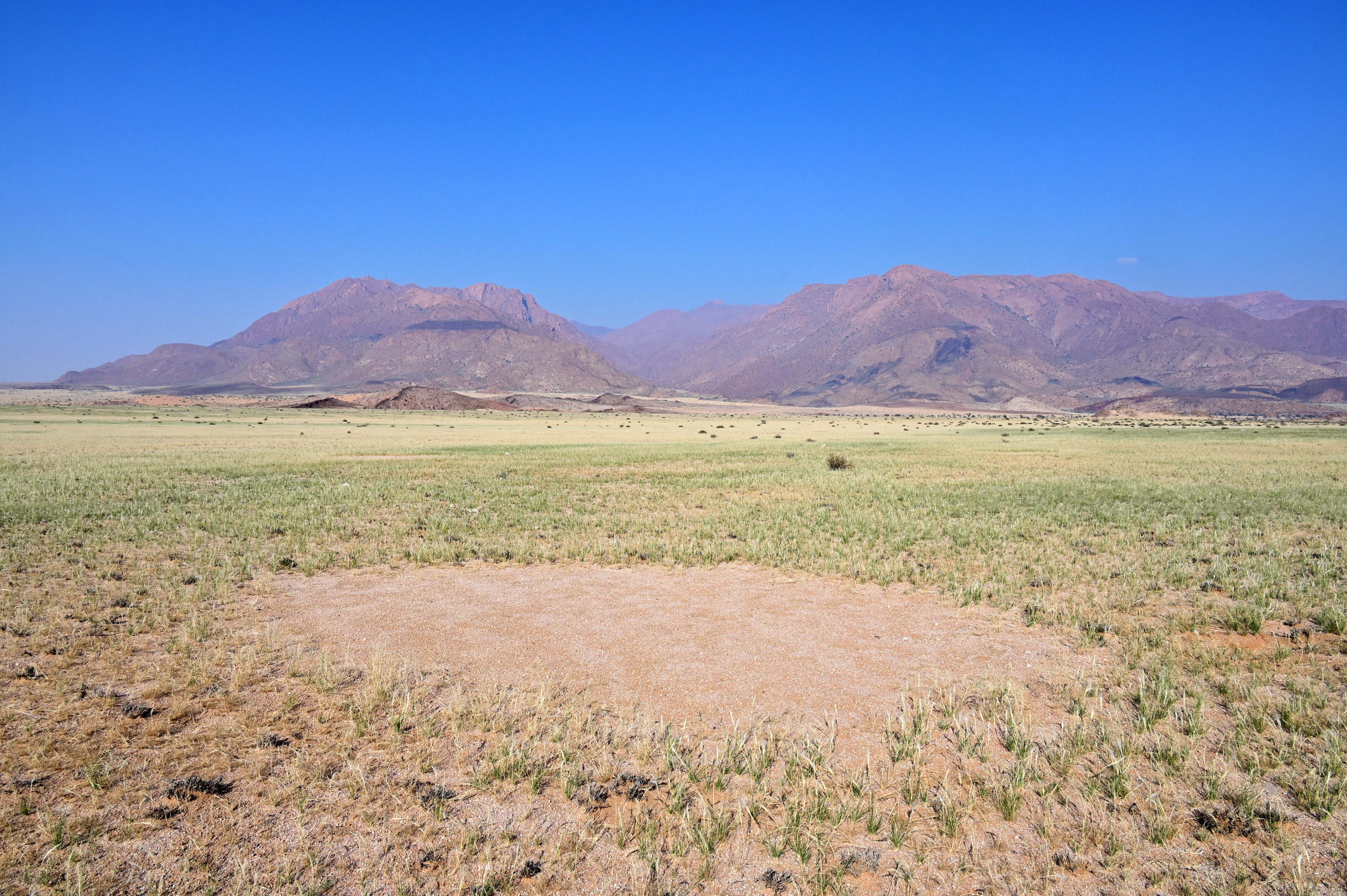
Today we go to the Damaraland. Instead of wide flat plains or sand dunes, you will now experience a more hilly and rocky landscape. On our tour we will see striking elevations such as the Spitzkoppe or Namibia’s highest mountain, the Brandberg. You can decide whether you want to see the Spitzkoppe up close or from a distance. If you prefer to drive to Cape Cross with its huge seal colony, then we will only see the Spitzkoppe from a distance. Instead, we will visit the world’s largest breeding colony of Cape fur seals (Arctocephalus pusillus), which numbers up to 210,000 seals during the breeding season in November and December. Cape fur seals belong to the eared seal family, which makes a lot of noise in such large numbers and has a very “intense” smell. Next to the colony is a cross erected there in 1486 by the Portuguese navigator Diego Cão. He was the first European to reach this place. If you would prefer to visit the Spitzkoppe, we will drive to the Brandberg on a more southerly route. The 1728 m high Spitzkoppe is an extraordinary mountain – it is also called the Matterhorn of Namibia. The granite rock rises about 670 m above the surrounding plains. Throughout the whole area there are smaller rounded rock formations, most of which can be easily climbed due to the flat slopes and porous granite surface. Often one can hear the echo of the calls of flying pale-winged starlings in the rocky gorges, which are easy to recognize with their white wings and black bodies. The Spitzkoppe is a paradise for nature lovers. Photographers get their money’s worth and we will therefore take a longer break on site. After lunch we continue northwards to the small settlement of Uis, where we will also stop. Uis is known for its tin mine, which was closed for many years but is now back in operation. Nowadays, some Namibians are retiring here, because the place is so tranquil and has little in common with the more hectic Windhoek. After leaving Uis behind us, we can see to the west the highest mountain of Namibia which is the Brandberg with 2573 m rising above sea level. Here near the Brandberg there is also another hotspot with fairy circles, which in that high concentration occur only further north, for example, in the Giribes Plains or the Marienfluss Valley. Directly next to the Brandberg is the Ugab River which can only flow during the rainy season.The Brandberg White Lady Lodge, where we will spend the night, is also located on the Ugab. This lodge is a truly green oasis on the very dry Brandberg. It offers a beautiful pool, a well-groomed garden, an elevated sundowner spot and perhaps the best milkshakes in Namibia. In the lodge's popular safari tents, you get a wonderful impression of African nature. You can hear the nocturnal birds and cicadas through the tent walls, which is an incomparable experience. With a bit of luck, the next morning you can also marvel at elephants that regularly wander up and down the Ugab.
Included services: Accommodation, breakfast, dinner, park fees
-

Day 10
Brandberg - Twyfelfontein
-


If there are desert elephants in the vicinity of the lodge, we can go on a game drive in an open safari truck after breakfast. Here in the Ugab River you can get to know the elephants up close. Desert-adapted elephants are not a subspecies of their own, but compared to savanna elephants they have physical adaptations, which make it easier for them to survive in the dryland areas. Their feet are a little wider, so that they can walk better through deep sand. Desert-adapted elephants often have to travel very long distances of up to 70 km to get from one dry river bed to the next. This is because the dry rivers with their dense, year-round green trees and bushes are the main source of food for elephants in the northwest of Namibia. If the elephants are not there, we can take a hike to visit the rock carvings of the Brandberg, such as the “White Lady”. As part of the Research-Tour, I will introduce you to the fairy circles and euphorbia shrubs at Brandberg in more detail. I have several research areas there, which I have been mapping regularly with drones since 2020. Brandberg is a special region in terms of fairy circles, because many of the circles occur where the poisonous Euphorbia damarana also grows. Researchers from South Africa have therefore speculated that the euphorbias could cause fairy circles by dying and killing the grass around them. We have closely examined this theory of origin in a comprehensive study and were able to show that the euphorbias do not poison the grass, let alone cause fairy circles in this way. We then leave the Brandberg. From the Ugab towards the north, you can now see more and more of the wild animals typical of the Damaraland such as zebras, springboks, giraffes, kudus and, with exceptionally good luck, even a black rhinoceros. This is because in the Damaraland north of the Ugab, the huge area begins, where the local nature conservation project IRDNC has been working so successfully in the last decades. It was also here in the Damaraland that the establishment of the Save The Rhino Trust (SRT) in the early 1980s was a major contribution to protecting the black rhinoceros. An important SRT field station is still operating at the Ugab on the west side of the Brandberg, from where regular patrols are carried out to protect the rhinos. In the late afternoon we will arrive in the Twyfelfontein area, which is characterized by its bizarre landscape of many small granite outcrops. You will spend the night in the very comfortable Twyfelfontein Country Lodge. The lodge is beautifully integrated into the mountain landscape of Twyfelfontein and offers the best relaxation.
Included services: Accommodation, breakfast, dinner, game drive or visit to the rock paintings
-
Day 11
Twyfelfontein - Sesfontein
-


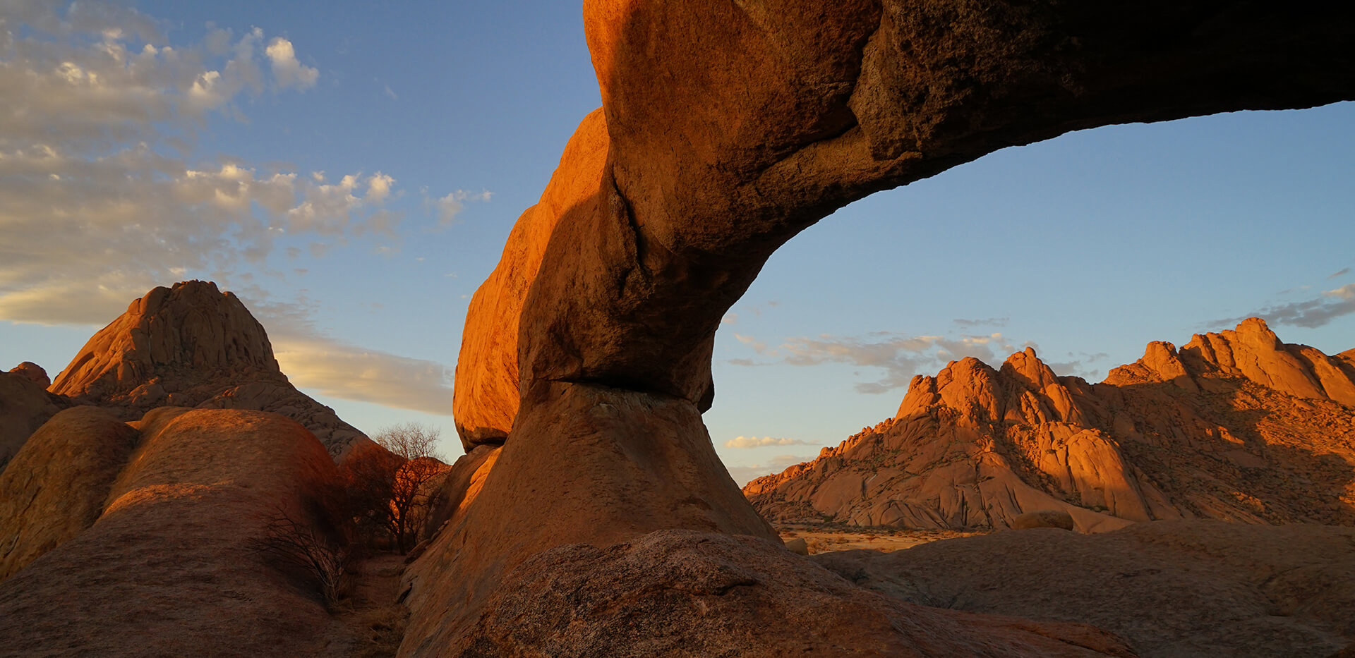
In the morning, you will get to know all the beauty of Damaraland and the region around Twyfelfontein on a four-hour drive in an open offroad vehicle. After breakfast we will explore the surroundings in the best photo light and look again for desert-adapted elephants. Very likely, we will find elephants in the Huab River bed this morning. Other wild animals such as ostriches and giraffes can also be observed in the Huab. On the way, we also pass fairy circles, which are scattered sporadically across the landscape. After our safari into the bush we can drive to the blackish Burnt Mountain and the Organ Pipes at Twyfelfontein. The Organ Pipes made of dolorite, a form of basalt, are of volcanic origin and were created by cooling down molten material. They form polygonal stone columns that look like organ pipes. If you wish, we can also visit the Twyfelfontein rock engravings, of which there are more than 2500 pieces and which can be several thousand years old. There is also the opportunity to visit the Living Museum of the Damara. Here you can get to know the culture of the Damara people. This sortiment of activities is merely an offer - you can decide which you prefer. Then we continue north. Here you will discover a new landscape in Damaraland – instead of granite inselbergs, large table mountains with flat plateaus now dominate the surroundings. These dark brown table mountains are part of the Etendeka Plateau, which is of volcanic origin and was formed over 130 million years ago. The barren but beautiful landscape is dotted with a carpet of stones everywhere, which is only loosened up by dry river courses or by individual Euphorbia bushes, Mopane trees or other shrubs. We will probably see some wildlife along the way on our trip through the Torra Conservancy, as almost all mammals – from lions to rhinos – are native to this communal area. Even wild leopards can be found with great luck right next to the road. The attraction of the Damaraland is probably exactly this: You are outside a national park in an area where humans with their sheep and goats are at home and yet you can see all kinds of free-roaming animals in the wild. Halfway between the Palmwag oasis and Sesfontein, the landscape changes again. We leave the dark brown rock of the Etendeka Plateau and enter a region characterized by lighter colors. Then we reach the mighty Hoanib-River and shortly thereafter Fort Sesfontein, where we will stay for two nights. Sesfontein is, so to speak, the gateway to the vast Kaokoveld, which stretches to the Angolan border. Sesfontein means “six springs” in Afrikaans. The good water supply also prompted the German colonial forces to build the fort here in 1896. Soldiers were stationed here to control poaching in the Kaokoveld.
Included services: Accommodation, breakfast, dinner, game drive or visit to the rock engravings
-

Day 12
Sesfontein
-


After breakfast at Fort Sesfontein, we will take a closer look at the fairy circles. The drive to the Giribes Plain is a bit of an off-road adventure, as the typical roads of the Kaokoveld begin behind Sesfontein. You can only drive very slowly here, as the road is rough and narrow in places. Upon reaching the Giribes Plain, we will soon see the first fairy circles. The circles there are particularly close together and quite large. We will first look at these typical fairy circles of the northern Giribes, which I have been studying since 2000. Then we will move on to huge fairy circles, so-called mega circles, which I discovered via Google Earth. These are over 20 m in diameter. Then we will head south, where we will soon see Leopard Rock. It is easy to climb up there. From the top, you have a beautiful view of the landscape. We will then continue west into a small valley. There is also a small hill there from which you can see particularly beautiful fairy circles. The circles there are almost perfectly round. In this valley, you will also encounter giraffes from time to time. I even saw a cheetah nearby once. Now we drive out of the valley again and head south. There are more extraordinary fairy circles there, stretching in a chain along drainage lines. They are extremely oval and over 32 m long. In 2019, we published a research article highlighting the special features of these unusual fairy circles. Finally, we drive to the southernmost end of the Giribes, where the very first fairy circle study was conducted by South African Karl Theron. In the late 1970s, he marked fairy circles, dying euphorbias, and other locations between the circles with metal rods to track possible changes over a long period of time. Theron's hypothesis was that the poisonous euphorbias could cause fairy circles over a long period of time after they died. I rediscovered these rods by chance in 2020, as there were no clues or GPS coordinates as to where they might be. Our renewed investigations of this area clearly showed that euphorbias do not cause fairy circles, because grasses grew exactly where the euphorbias died. In addition, the euphorbias were much smaller than the fairy circles in the area, which are up to 19 m in size, and the patterns of the euphorbias did not match the patterns of the fairy circles at all. We also wrote a publication on the euphorbia theory in 2021. This concludes the full-day excursion to the Giribes. On this day, you will have ample opportunity to learn everything there is to know about fairy circles. Now it's time to head back to Fort Sesfontein, where we will spend a leisurely evening. A dip in the pool is highly recommended in the heat.
Included services: Accommodation, breakfast, dinner
-

Day 13
Sesfontein - Vingerklip
-


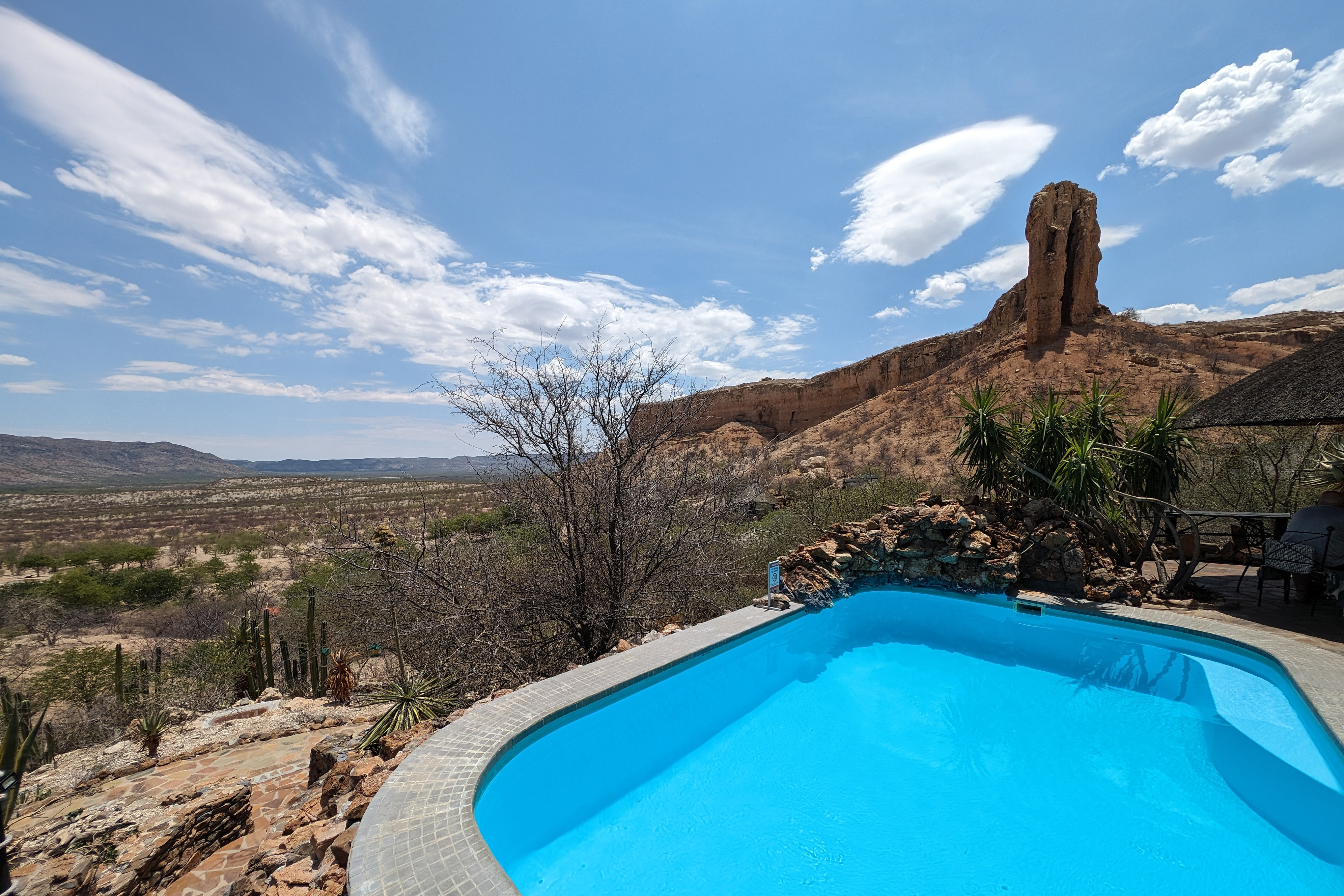
Now we leave Sesfontein again and drive southwest to Vingerklip Lodge. In the morning, we can make a detour to the wide Hoanib Valley. The Hoanib Valley is home to many wild animals such as antelopes, giraffes, elephants, and even lions. It is an impressive dry river that runs like a green vein to the Skeleton Coast. Shortly after Palmwag, we turn left and drive up the steep Grootberg Pass. There are beautiful viewpoints from which you can see the typical landscape of Damaraland with its table mountains. The connecting stage between Sesfontein and Vingerklip Lodge is quite long, taking five hours to drive. However, you will also see many different habitat types of Damaraland. In the afternoon, we will reach the beautifully situated Vingerklip Lodge. Here you can relax and unwind. The lodge offers a nice pool and many different places to rest. You can choose your favorite spot in the shade and relax undisturbed. There is also a waterhole nearby that attracts springboks, kudus, zebras, and other animal species. Here you can observe the wildlife at length with binoculars or a spotting scope. At sunset, a short hike to the plateau behind the lodge is definitely recommended. From here, the view over the vast landscape is most impressive. In the distance, you can also see the Vingerklip or rock finger very clearly. It is perhaps the most famous rock in Namibia. The 35-meter-high rock is a remnant of erosion, unique in its striking shape. We can visit this rock after arriving at the lodge or the next morning, depending on your preference.
Included services: Accommodation, breakfast, dinner
-

Day 14
Vingerklip - Mount Etjo
-


Today is unfortunately already the last full day of our trip and we continue to approach Windhoek. The drive from Vingerklip Lodge to Mount Etjo Safari Lodge is relatively short, taking only two and a half hours. This day will therefore once again focus on relaxation. Those who would like to hike around Vingerklip Lodge in the morning will have plenty of time to do so. We will arrive at Mount Etjo in the early afternoon. The Safari Lodge offers you another real highlight on your last day, as we will go on safari in the afternoon and take a game drive through the bush. Here we will see the entire wildlife of the Namibian savanna up close. Elephants, zebras, giraffes, sable antelopes, and even white and black rhinos can be found in the bush. The high density of wildlife and diversity can be traced back to conservationist Jan Oelofse, who founded the Okonjati Game Reserve at Mount Etjo in 1975. Jan Oelofse is a celebrity because he developed certain game capture techniques that revolutionized the capture of wild animals. In 1968, he came up with the idea of capturing animals in large numbers using woven opaque plastic sheets and a helicopter. This technique is now known as the “Oelofse method.” In 1960, he was also primarily responsible for capturing and training wild animals in what was then Tanganyika, now Tanzania, when the film “Hatari” was shot. Oelofse worked for Paramount Pictures and, with his experience in handling wild animals, was of great value to actors such as John Wayne and Hardy Krüger, who caught big game in breakneck stunts from moving cars. Mount Etjo Safari Lodge is also known for another historical event. It was here on April 9, 1989, that Namibia's independence was initiated, when high-ranking politicians and international observers met at the lodge to sign the “Mount Etjo Declaration”. This paved the way for Namibia's independence on March 21, 1990. At the end of the day, we will enjoy dinner and you can then reflect on all the impressions of the day and the entire Research Tour under the starry sky of Namibia.
Included services: Accommodation, breakfast, dinner, game drive
-

Day 15
Mount Etjo - Departure from Windhoek
-


Since most return flights do not depart until the evening, you can spend your last day relaxing. The journey from the lodge to Windhoek Airport takes approximately three hours, giving you plenty of time to reach the airport in the afternoon.


 in Daan Viljoen Game Park")


, people (center), and giraffes (right)")


 and ana trees (yellow) grow along the river")


 and dollar bush (right) have special leaves to protect themselves from evaporation")


Experience desert research firsthand:
- How do grass species respond to grazing?
- Why are many plants forming rings?
- What survival strategies do moringa trees use?
- What is the importance of dry rivers?
- How toxic are euphorbias really?
- Why are there elongated fairy circles
Welcome to NAMIBIA-ECO-TOURS – your specialist for privately guided individual tours through Namibia. On our exclusive tour, you will benefit from my 25 years of experience as a desert researcher and ecologist in the Namib.
